Thursday 3 November 2011

Royal Sites of Ireland: Tara

I'm taking a class at NUIG called Landscapes of Cult and Kingship: The Ancient Royal Sites of Ireland.  For the class we went on a Field Trip to two of these sites, The Hill of Tara and Navan Fort in Armagh.  Royal Sites are where the kings of the different provinces of Ireland were crowned and may have lived.

First we went to the Hill of Tara.  The Hill of Tara is part of a large landscape combined of different monuments. Its probably the most sacred place in Ireland.
The Banquet hall looking up to the top of the hill of Tara.
The Banquet Hall looking down into the valley from the top of the Hill of Tara.

 When a king came to Tara to be crowned, he would walk up to the hill through the banquet hall.  Although the monument is called the banquet hall, it doesn't resemble a banquet hall in any way except that it is long and rectangular-ish in shape (in reality it has a slight curve to it).  The banquet hall at Tara is a large ditch lined on two sides by large embankments which make a kind of tunnel or pathway up to the top of the hill.
                                         
 As on exits the banquet hall the Mound of Hostages begins to appear.  The Mound of the Hostages is the oldest monument on the Hill of Tara.  It is a tomb, and it may have gotten its name because the ancient chiefs of Ireland would exchange their hostages at Tara.

 View out from the Hill of Tara
 View from the Hill of Tara
 View from the Hill of Tara 
 Mound of the Hostages
 Graveyard on top of the Hill of Tara outside the Church that was built there after Ireland became Christian.
 Mound of Hostages with the Church in the background
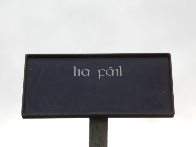
Lia fail or the Stone of Destiny

  Lia fial or the Stone of Destiny
 View from the Hill of Tara.
 View from the Hill of Tara 
 A barrow on top of the Hill of Tara

Friday 14 October 2011

Field Trip!!!

Sorry I haven't posted in forever.  School is getting busier and I've been doing more events with the clubs.  I've still been exploring the different places around Galway.  I walked to Mutton Island which is off the coast of Galway City and connected by a boardwalk.  You can't actually go onto the island, because its a sewage treatment plant, but the views from the boardwalk out there are very pretty.  Two weeks ago I went on a field trip to Co. Roscommon where we saw Roscommon Castle, Roscommon Abbey and Rindown Castle.  I

 Me on the boardwalk looking onto Salthill area of Galway 
 Looking towards Salthill.
 Galway Bay

 Galway City

 Galway City

 The Spanish Arch
 Latin Quarter of Galway
 Roscommon Castle, front of the castle.

 Roscommon Castle. Main entrance of the castle.
 Roscommon Castle


 Roscommon Castle


 Countryside around Roscommon


 The garden around Roscommon Castle
 Roscommon Abbey

 Roscommon Abbey
 The tomb of the founder of Roscommon Abbey, Falem O'Conor.

 Warning sign before entering onto the grounds of Rindown Castle.
 Cows and the old graveyard by Rindown

 Town wall of Rindoon. Built around 1250.
 Rindown is built on a peninsula on Lough Ree. 


 Rindown Castle


 View of Lough Ree and some sheep.
 View of Rindown Castle from safe harbor.  You can actually see the High Medieval docks in the harbor, but they are currently under water.

 Inside of Rindoon Castle


The church built for the people of Rindoon, the town.

Monday 26 September 2011

A Hike up Diamond Hill and the Oyster Festival and Arthur Guinness Day

This weekend was really busy, starting on Thursday which was the kick off to Guinness Live in Galway and Arthur Guinness Day.  Arthur Guinness Day is in celebration of when Arthur Guinness signed a 9,000 year lease on the St. James's Gate Brewery in Dublin.  He signed it in 1759 on 22nd of September and therefore at 17:59 (5:59) on the 22nd of September there was a giant celebration in the streets of Galway in honor of Arthur Guinness.


 A half pint of Guinness and a portrait of Arthur Guinness
 The ceiling of the Skeff, a really old and beautiful pub in Galway.
More of the interior of the Skeff

Then Friday kicked off the Galway Oyster Festival.  Most of the events of the festival were pretty pricey, so I didn't go the official events, but just the fact that it was occurring gave Galway a festive air.  There were street vendors and people on the main street all day playing music, all the pubs had live music every night.  It was a lot of fun and my friends and I ate a plate of oysters in celebration.


Guinness Live was just a continuation of Arthur's Day for the whole weekend.  It was a lot of fun, since all the pubs brought in good bands.


 This is the brochure for the event.

On Saturday, I went with my schools Hiking Club to Connemara National Park which is a northwest of Galway.  The landscape of Connemara was ethereal. The hills had this hazy glow to them, the writer Kate O'Brien described it best: "There is often an illusion that all is afloat, an uncertainty between hill and sky, an interchange of water and stone which the indescribably clear light seems to paradoxically exaggerate."  The hiking club climbed Diamond Hill (2,385 ft.) which is just outside the town of Letterfrack.  The hike was a blast, although it was very windy at the top and a little scary.


 Heather
Looking out onto Ballynakill Harbour.
 Diamond Hill
 Hiking up to Diamond Hill
 Looking out from Diamond Hill onto the Harbour again

 Diamond Hill
 From the top of Diamond Hill looking down onto Kylemore Abbey, which I'm going to visit next weekend or the weekend after.
 Top of Diamond Hill with Emily

 The Connemara landscape.  It's really boggy, rocky, and peaty, but somehow still beautiful.
 The way down


 That's the path, lots of rock steps and boardwalks to keep you out of the boggy areas.


 Diamond Hill


 The little town down there is Letterfrack.  We went there after the hike and had dinner at a pub.
 Diamond Hill
 Here is the map of the trail we took.  We started on bog road and then hiked up to Upper Diamond hill walk and finished the light blue loop on the way down using the upper trail.
The Mileage

I was exhausted.